Pacific encounters · 1768-1779

James Cook and the Pacific

In three voyages James Cook charts more of the Pacific than any European before him. Students follow his ships from Tahiti to New Zealand, Australia and Hawai'i, meet the Pacific navigators and Indigenous peoples he encountered, and ask what these meetings meant for both sides.

Duur
50 minuten
Leeftijd
11–14
Op de kaart
3 stappen, 1770 n.Chr. tot 1779 n.Chr.
Live les
7 rondes, 3 op de kaart
Huiswerk
Dezelfde rondes, een week lang
Werkblad
Twee A4’s, bij Classroom
Dia’s
22 dia’s, bij Classroom
Je hebt nodig
Een beamer; telefoons voor live
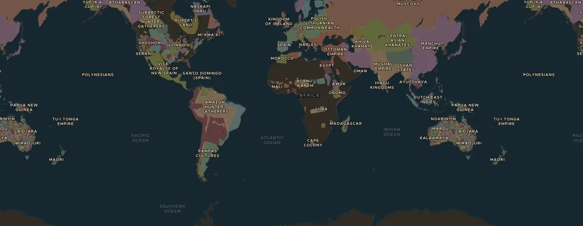
Kaartplaat 390Pacific encounters, 1770 n.Chr.. De letters geven de drie kaartstappen van deze les aan.

Een telefoontje uit het verleden · nieuw

Tupaia hangt aan de lijn. De klas beslist.

June 1769, after observing the transit of Venus at Tahiti
Aboard HMS Endeavour, Tahiti

“You must decide whether to join Captain Cook and his crew as they sail from Tahiti to new islands, using your knowledge of Pacific navigation and languages. If you go, you may help them find safe routes and speak with islanders, but you risk sickness and danger far from home. If you stay, you remain safe but cannot share your skills or learn from their journey.”

Should I join Cook's voyage to distant islands, or remain in Tahiti? De beller spreekt Engels, met zijn of haar eigen stem, vanuit een korte samenvatting van feiten uit het lesboek, weet niets van wat later gebeurde en vertelt nooit de afloop; dat zie je na het gesprek op het scherm. Op het livebord rinkelt de telefoon voor de hele klas: de docent neemt op via de microfoon, leerlingen sturen hun antwoord via hun telefoon.

Log in om het telefoontje op te nemen

Telefoontjes zitten bij Pro (5 per maand) en Classroom (20 per maand, voor de hele klas). Hoe telefoontjes werken

Live les · nieuw in Classroom

Geef live les. De klas antwoordt via hun telefoon.

Zet het bord op de beamer. Leerlingen doen mee met een zescijferige code, geen account nodig, en tikken op de kaart: waar lag de grens, waar kwam het graan vandaan. Hun pins verschijnen tegelijk als je onthult, en de leerling die het dichtstbij zit wint de ronde.

€19 per maand: elke les live, alle werkbladen, maandelijks opzegbaar. Rome op zijn grootst loopt gratis live.

Een live les op het digibord: de pins van de klas op de kaart rond Alexandrië, met de dichtstbijzijnde leerlingen ernaast. Op de telefoon van de leerling: de vraag en een kaart om op te tikken.
7 rondes
3 plekken zoeken op de kaart, quizvragen, een klassenstemming en een kort antwoord.
Ongeveer 15 minuten
Gebruik het als kaartopdracht of als start van het gesprek. Je gaat verder met de spatiebalk.
Een rapport
Alle antwoorden, per leerling en per ronde, om terug te lezen of te printen na de les.

Of als huiswerk · nieuw

Geen lestijd over? Zet het als huiswerk klaar.

Dezelfde 7 rondes, zonder digibord: elke leerling doorloopt ze zelf op de telefoon, ziet meteen alle antwoorden met uitleg, en het rapport vult zich automatisch. Een week open, met een code en een link die je overal kunt delen.

Huiswerk hoort bij Classroom, net als de live les. De gratis les kan iedereen als huiswerk geven.

Pacific encountersJames Cook and the Pacific

Dia’s · nieuw

De hele les als presentatie.

22 slides: het titelblad, de 3 kaartstappen met afbeeldingen en een link naar de live kaart, de gespreksvragen, de quiz met het antwoord op de volgende slide, en het werkblad. In de sprekersnotities staat wat je kunt zeggen. Het is een .pptx, dus werkt in PowerPoint, Keynote en Google Slides, en je kunt alles aanpassen.

Voorbeeld: de eerste 4 slides

€19 per maand: de presentatie van elke les, alle werkbladen, elke live les. Rome op zijn grootst is helemaal gratis beschikbaar.

1

Introductie

5 min

Lees voor

In three voyages James Cook charts more of the Pacific than any European before him. Students follow his ships from Tahiti to New Zealand, Australia and Hawai'i, meet the Pacific navigators and Indigenous peoples he encountered, and ask what these meetings meant for both sides.

Aan het eind van de les kunnen leerlingen

  • Trace Cook's voyages on the map and name three places he reached.
  • Explain the scientific aims of the voyages, such as observing the transit of Venus.
  • Describe the encounters from the point of view of Pacific peoples as well as Europeans.
2

Ontdek de kaart

15 min

Projecteer de kaart, of laat leerlingen zelf meekijken. Elke stap opent de kaart op het juiste jaar en de juiste plek.

De kaart in 1770 n.Chr. a

1770 n.Chr.

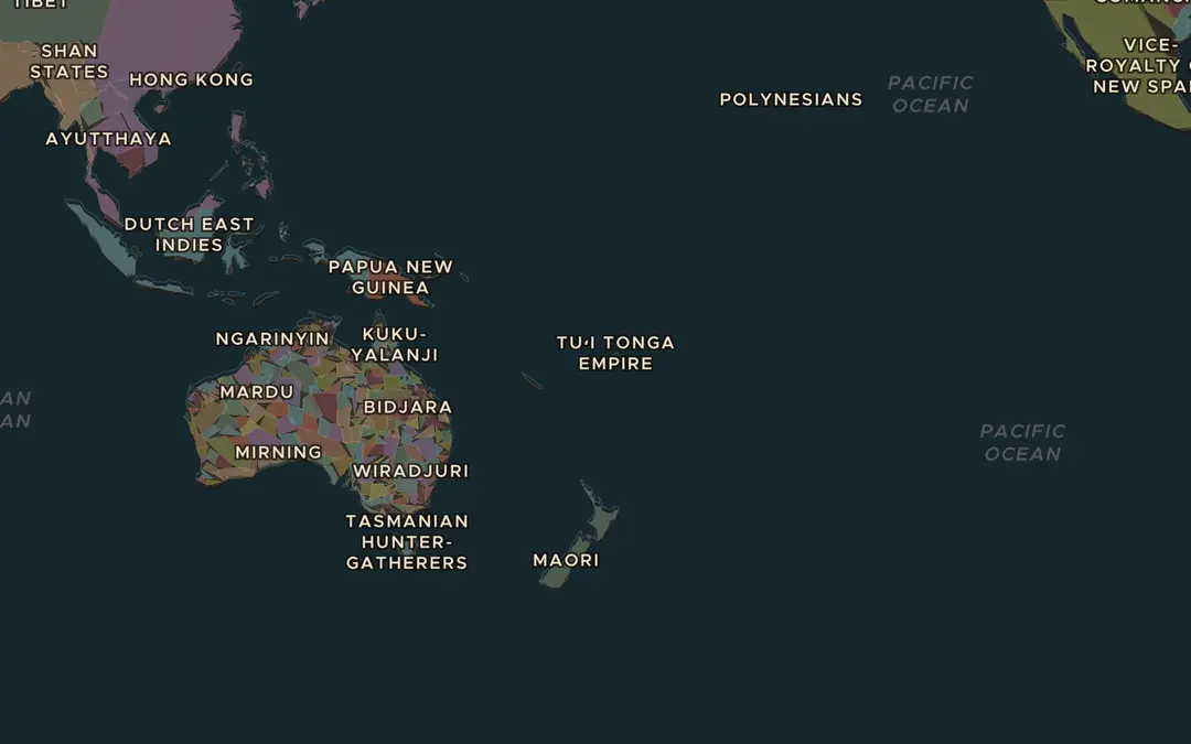
A sea of islands

Open the map in 1770 and zoom out over the Pacific Ocean. Find Tahiti, New Zealand, the east coast of Australia and Hawai'i. People had lived on all of them long before Cook. How did they get there?

Open dit beeld op de kaart
De kaart in 1770 n.Chr. b

1770 n.Chr.

Two Pacific crossings

Open Stories and play the journey of Magellan & Elcano across the Pacific. Compare it with Cook's first route from Tahiti to New Zealand and Australia. What had changed in 250 years of sailing?

Open dit beeld op de kaart
De kaart in 1779 n.Chr. c

1779 n.Chr.

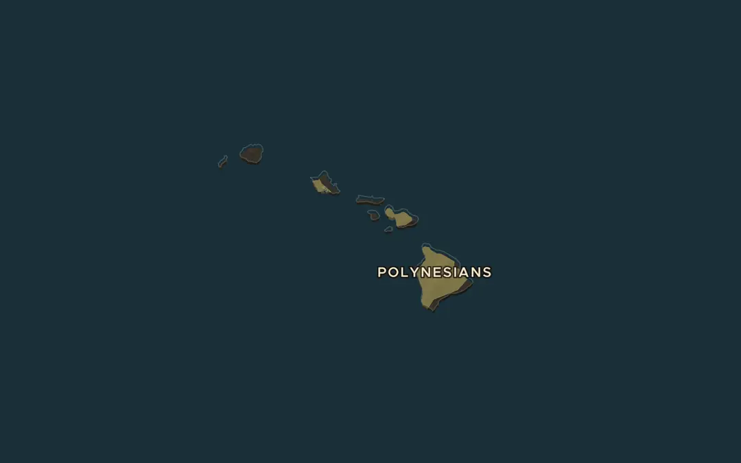
Hawai'i

Zoom in on Hawai'i in 1779. In 1778 Cook became the first known European to reach these islands, then ruled by several powerful chiefs. Why were islands in the middle of the ocean so valuable to sailors?

Open dit beeld op de kaart
3

Klassengesprek

15 min

Kies er twee of drie. Ze gaan van wat er gebeurde naar waarom het belangrijk was.

  1. Scientists asked Cook to watch Venus pass across the Sun from Tahiti. Why would they send a ship around the world for that?
  2. The navigator Tupaia drew a chart of dozens of islands from memory. What does that tell us about Pacific navigation?
  3. Cook claimed the east coast of Australia for Britain in 1770 without asking the people who lived there. Why is that still debated today?
  4. Cook's crews suffered less from scurvy than many earlier crews. Why did that matter for long voyages?
  5. Some remember Cook as a great navigator, others as the beginning of colonisation. Can both be true?
4

Spelronde

10 min

Play a round of Rule History as Catherine the Great. In 1778 Cook met Russian fur traders on the Aleutian island of Unalaska, subjects of her empire. Discuss: why were so many empires reaching into the Pacific at the same time?

Open Rule History
5

Werkblad

5 min

Dit werkblad hoort bij Classroom

Voor €19 per maand krijg je alle werkbladen, slides van elke les, elke live les en het klaslokaal. De gratis les kun je altijd printen.