
 a
Three continents
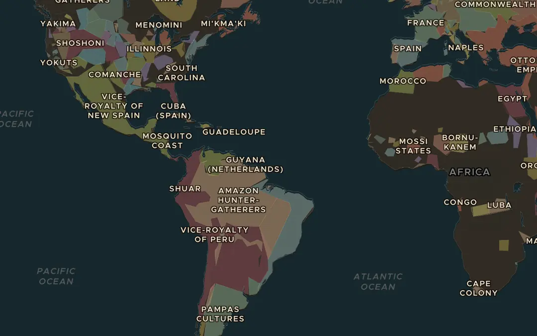
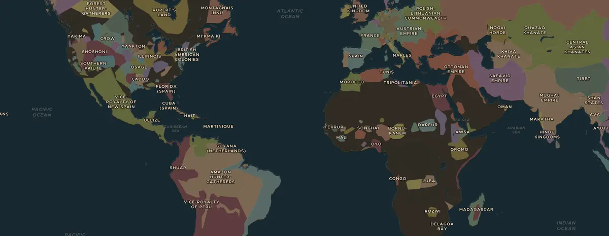
Open the map in 1750 and turn on Trade Routes. Follow the Atlantic Triangular Trade between Europe, West Africa and the Americas. What was carried on each side of the triangle?
Open dit beeld op de kaartAtlantic world · 1500s-1860s
For more than three centuries, about 12.5 million Africans were forced onto ships bound for the Americas. Students map where captives came from and where they were taken, hear the voices of those who survived, and ask how this history should be remembered.
Live les · nieuw in Classroom
Zet het bord op de beamer. Leerlingen doen mee met een zescijferige code, geen account nodig, en tikken op de kaart: waar lag de grens, waar kwam het graan vandaan. Hun pins verschijnen tegelijk als je onthult, en de leerling die het dichtstbij zit wint de ronde.
€19 per maand: elke les live, alle werkbladen, maandelijks opzegbaar. Rome op zijn grootst loopt gratis live.


Of als huiswerk · nieuw
Dezelfde 7 rondes, zonder digibord: elke leerling doorloopt ze zelf op de telefoon, ziet meteen alle antwoorden met uitleg, en het rapport vult zich automatisch. Een week open, met een code en een link die je overal kunt delen.
Huiswerk hoort bij Classroom, net als de live les. De gratis les kan iedereen als huiswerk geven.
 Atlantic worldThe Middle Passage and the Atlantic slave trade
Dia’s · nieuw
22 slides: het titelblad, de 3 kaartstappen met afbeeldingen en een link naar de live kaart, de gespreksvragen, de quiz met het antwoord op de volgende slide, en het werkblad. In de sprekersnotities staat wat je kunt zeggen. Het is een .pptx, dus werkt in PowerPoint, Keynote en Google Slides, en je kunt alles aanpassen.
€19 per maand: de presentatie van elke les, alle werkbladen, elke live les. Rome op zijn grootst is helemaal gratis beschikbaar.
Lees voor
For more than three centuries, about 12.5 million Africans were forced onto ships bound for the Americas. Students map where captives came from and where they were taken, hear the voices of those who survived, and ask how this history should be remembered.
Aan het eind van de les kunnen leerlingen
Projecteer de kaart, of laat leerlingen zelf meekijken. Elke stap opent de kaart op het juiste jaar en de juiste plek.
a
Open the map in 1750 and turn on Trade Routes. Follow the Atlantic Triangular Trade between Europe, West Africa and the Americas. What was carried on each side of the triangle?
Open dit beeld op de kaart
b
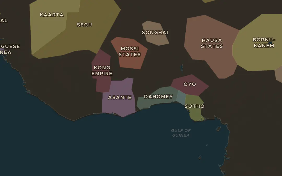
Jump to 1783 and zoom in on the coast of West Africa. Find states such as Asante, Oyo and Dahomey inland. European traders mostly stayed in forts on the coast. Why could they not simply march inland?
Open dit beeld op de kaart
c
Zoom out to the Atlantic. Find Brazil, the Caribbean islands and the east coast of North America. Which region do you think received the most captives? Check your guess during the lesson.
Open dit beeld op de kaartKies er twee of drie. Ze gaan van wat er gebeurde naar waarom het belangrijk was.
Play a round of Rule History as Elizabeth I. In the 1560s she backed the voyages of John Hawkins, the first English slaving voyages. Discuss: which decisions in the game have consequences for people who never had a say?
Open Rule HistoryVoor €19 per maand krijg je alle werkbladen, slides van elke les, elke live les en het klaslokaal. De gratis les kun je altijd printen.