Lesson · Roman Empire
Rome at its height
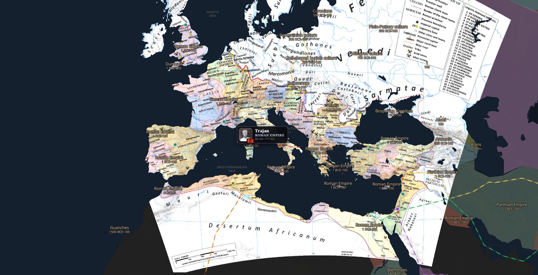
Under emperor Trajan the empire reaches its greatest size. Students explore how far Rome really stretched, and what held such a giant together.
117 AD
Ages 11-14
50 min
Free lesson
Learning objectives
- Describe the extent of the Roman Empire in 117 AD in their own words.
- Name three regions under Roman rule outside Italy.
- Explain one way Rome kept a huge empire connected (roads, army, trade).
On the map
1
The empire at its peak
Open the map in 117 AD. Zoom out until you see the whole empire. Which three continents does it touch?
Open the map here117 AD
2
The edge of empire
Travel to Britain. Find the northern border. Why do you think the Romans stopped here?
Open the map here117 AD
3
Trade routes
Turn on the trade routes layer. Follow a route from Rome to Egypt. What was worth shipping that far?
Open the map here117 AD
Discussion questions
- Why was the Mediterranean Sea called "Mare Nostrum" (our sea) by the Romans?
- The empire had about 80,000 km of roads. What were they for, besides trade?
- Rome ruled people with many languages and religions. How would you keep them all loyal?
- Look at the borders: rivers, deserts, seas. Why do empires often stop at natural barriers?
- What do you think was the biggest risk of an empire this size?
Game round
Play one round of Rule History together on the classroom screen. Set the map to the Roman era and let students take turns making a ruling. Discuss: was your choice realistic for a Roman emperor?
Open Rule HistoryWorksheet
- Draw the outline of the Roman Empire in 117 AD on the blank map below (use the ChronoAtlas map as your source).
- Mark and name: Rome, Alexandria, Londinium (London) and the Rhine border.
- Name three provinces outside Italy and one product each was known for.
- In two sentences: why did the empire stop expanding after Trajan?
- Bonus: find on the map one city that still exists today under a different name.
Prints as a clean A4 for your students: name fields, writing lines under every task and a map sketch box. Nothing else from this page ends up on paper.
Rome at its height
Name:Class:Date:
- Draw the outline of the Roman Empire in 117 AD on the blank map below (use the ChronoAtlas map as your source).
- Mark and name: Rome, Alexandria, Londinium (London) and the Rhine border.
- Name three provinces outside Italy and one product each was known for.
- In two sentences: why did the empire stop expanding after Trajan?
- Bonus: find on the map one city that still exists today under a different name.
Map sketch area - use chronoatlas.nl as your source